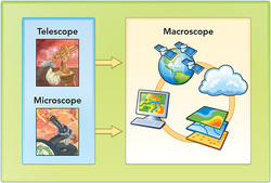
 The Macroscope courtesy of ESRI
 I remember hearing about the greatest innovation of our age-- the macroscope. If we assign the paradigm shift that occurred in 2007, as the ubiquity of user generated content (web2), we have to acknowledge that the second most trans formative discovery was that of the macroscope, intoduced in the article, "Geography's View of the World", By Jerome E. Dobson, Professor of Geography, University of Kansas.
It seems that our mooc facilitators are bringing us down the path of Particpatory 3DGIS. If I had another career it would be in GIS. An incredible tool for inclusion and exclusion, mapping, like any scientific inquiry presupposes the answer and contains the bias of its inquirer. That's what so cool about participatory mapping in 3D. It is the web 2 of mapping. It mixes it up and includes wisdom not found in assumptions but through a deep knowledge of place.
"One of the reasons that tacit knowledge is being surfaced during P3DM is that the relief model helps different elders reflect on their own knowledge and listen to each other. It makes tacit knowledge become coherent and identifiable for the holders of that knowledge. This can be missed using other techniques. It is the link between memory, land and maps which creates a particular focus."
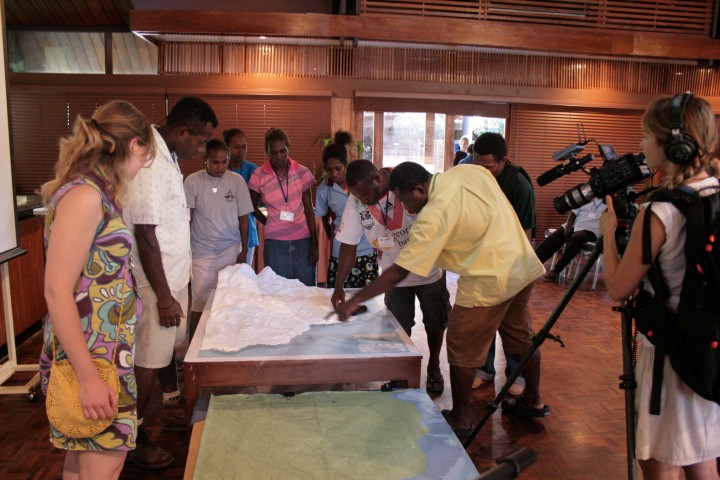
Mapping in 3D, Intimate Place based Wisdom
Isn't this what we are trying to do in our #CLMOOC? Spatial knowledge embedded with something deeper. Our spiritual journey, our memories and history, or path to each other. There is a tremendous amount of untapped wisdom in this. I wonder what it would look like? And for me it is a metaphor of our struggle with homogenization, the common core. The tools of PPGIS are common, but the context is unique. Which should inform which? Similar forces are at work, in any map. ie., Here are the coal deposits. No, sorry, there aren't any endangered species there. This is the way to get there, through this town, not that. Put the road in here. That kind of thing. I am reflecting about this as I try to create my map. Spatial and spiritual, past and present.
 RSS Feed